-
Location
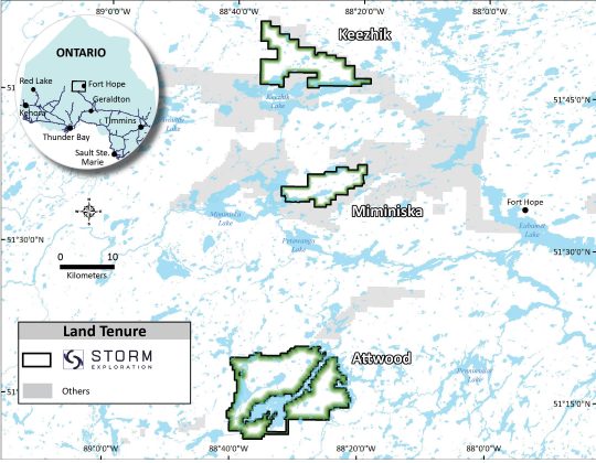
The Miminiska Project is located in north-western Ontario approximately 350 km north of the city of Thunder Bay and within the traditional territory of the Eabametoong First Nation. The property comprises 52 patented mineral claims and 278 mineral claim cells covering 5,494 ha and is accessible by floatplane.

-
Highlights
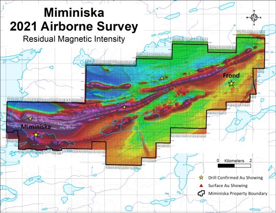
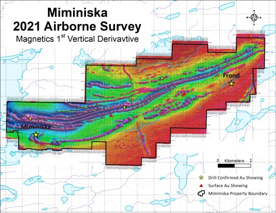
- Two drill-confirmed high-grade gold zones separated by 14km: Miminiska & Frond
- Significant drill intersections include 5.75 g/t Au over 20.84m* and 13.95 g/t Au over 5.32m*
- Gold mineralization is hosted in banded iron formation and associated shear zones that extend across the property for 14 km
- Several additional confirmed gold showings located on the property
- Extensive database of historical information including results from more than 25,000m of drilling
- Intermittent historical exploration concentrated on zones of known gold mineralization
-
History
*Under Construction – Stay Tuned
-
Technical Details
Geologically, the project lies within the Miminiska – Fort Hope greenstone belt approximately 115 km east of the town of Pickle Lake and 180km southeast of Newmont Corporation’s Musselwhite Mine. Gold mineralization occurs over 14 km and is primarily associated with iron-formations and east-west striking shear zones.
Storm Exploration has an extensive database of historical information on Miminiska, including results from more than 25,000m of drilling. Historical exploration has focused on two prospects, Miminiska and Frond, where high-grade gold over mineable widths has been confirmed in numerous drill holes. In addition, several showings have been identified in the 14 km that separate the Miminiska and Frond prospects.
Drilling conducted by Storm Exploration at the Miminiska prospect in 2022 extended the high-grade gold mineralization by more than 130 m along strike and confirmed the effectiveness of electromagnetic surveys as a targeting tool. Next steps include more drilling at the Miminiska prospect to expand and extend mineralization there as well as conducting a property-wide airborne electromagnetic survey to develop additional drill targets on the project.

Selected Historical Miminiska Drill Results*
Area Drill Hole From (m) To (m) Interval (m) Au (g/t) Miminiska 0603-8 51.94 72.78 20.84 5.75 0604-32 235.78 241.10 5.32 13.95 88C-10 54.59 69.34 14.75 3.74 0603-18 120.57 131.75 11.18 4.49 0603-17 43.48 61.22 17.74 2.49 Frond 148C 27.74 31.46 3.72 12.54 11 16.76 19.81 3.05 13.36 65 91.62 97.72 6.10 6.68 39 19.42 21.52 2.10 18.64 47C 34.47 37.80 3.32 8.85 *Historical assays have not been independently verified by Lithoquest; and, there is no guarantee that the Company can reproduce the results in whole or in part. Potential investors should not rely on these historical results when making an investment decision.


